
MANILA — Weather bureau PAGASA said Tuesday it was monitoring three low pressure areas in and outside the Philippine area of responsibility.
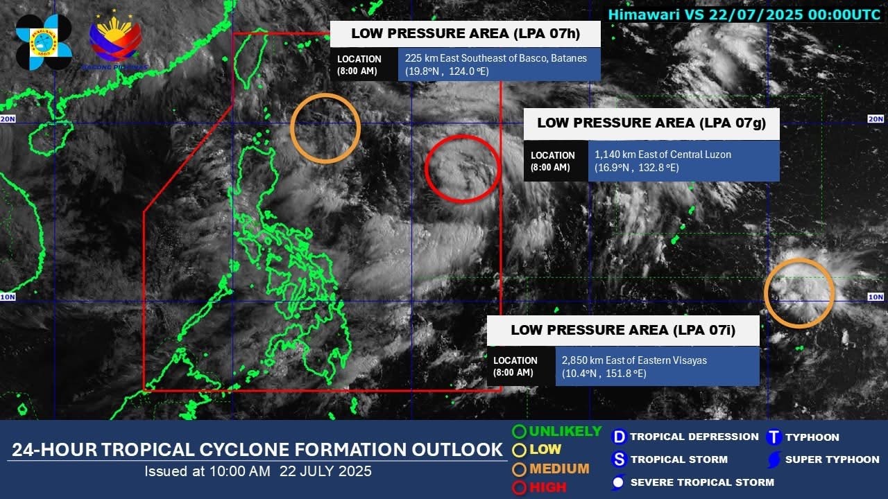
As of 8 a.m., the LPA spotted more than 1,100 km far east of Central Luzon had a high potential for developing into a tropical cyclone in the next 24 hours.
The second LPA over the Philippine Sea was moving closer to Luzon’s northern tip. It was spotted 225 km east southeast of Basco, Batanes.
The third LPA formed on Tuesday morning was still outside the PAR, located 2,850 km east of Eastern Visayas.
The latter two LPAs have a medium chance for tropical cyclone development, PAGASA said.
Whichever of the LPAs over the Philippine Sea that may form first will enhance the southwest monsoon or habagat, which will dump significant rains over Luzon and western Visayas through Friday, the weather bureau said.
Habagat dumps almost a month's rain in Cavite, 2 weeks of rain in QC
It said up to torrential rains (more than 200 millimeters or around 8 inches) were expected in Pangasinan, Zambales, Bataan, Cavite, Batangas, Occidental Mindoro, and Metro Manila.
Marcos suspends SONA preps as PH suffers severe flooding
Metro Manila drainage system ‘very old’, no longer ‘adequate’ in preventing floods: DPWH