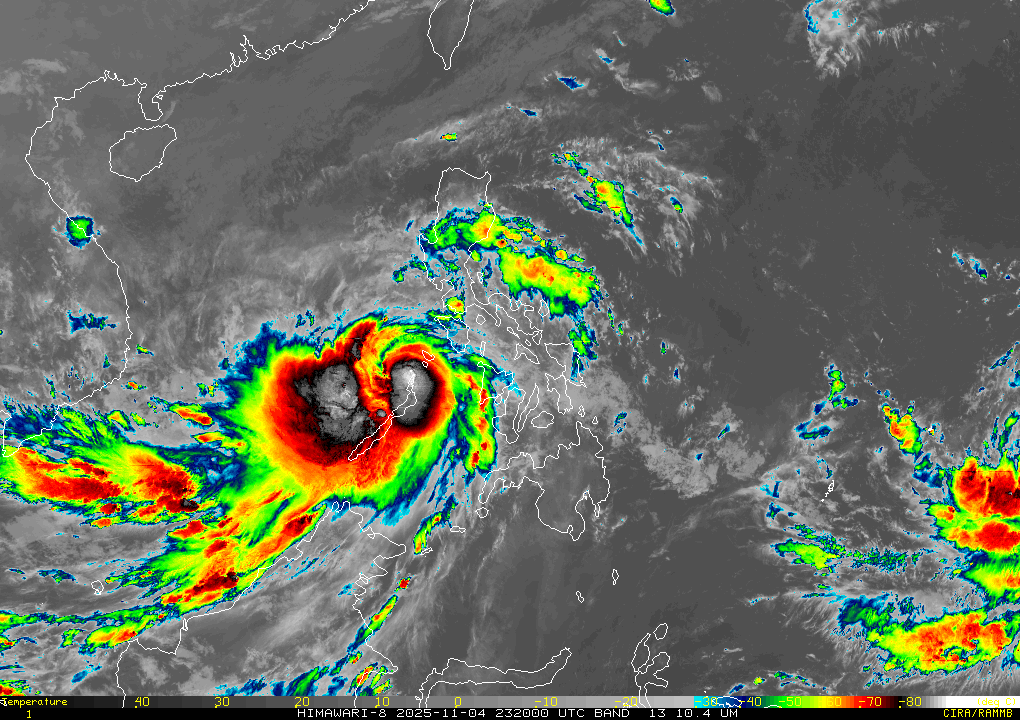
 RAMB/US NOAA/Himawari
MANILA — Typhoon Tino slightly intensified on Wednesday morning while moving away from northern Palawan, state weather bureau PAGASA said.
At 10 a.m., it was spotted 190 kilometers west of Coron, Palawan, packing winds of 130 kilometers per hour and up to 180 kph gusts. It was moving west northwestward at 20 kph.
PAGASA kept wind signal no. 4 raised over El Nido, Palawan.
Other areas under wind signals include the following.
- Signal no. 3: northern Palawan including Calamian Islands
- Signal no. 2: eastern and central Palawan and Kalayaan Islands
- Signal no. 1: Occidental Mindoro, southern Oriental Mindoro, and southern Palawan including Cuyo Islands
Tino will continue to move away from the country and exit the Philippine area of responsibility late Wednesday or early Thursday.
Earlier Wednesday, Tino had toppled trees and stripped the roofs off several houses in Palawan’s Cuyo, Magsaysay, and Agutaya towns.
A telco tower fell down in Barangay Sibaltan, El Nido.
Heavy rains from Tino spawned floods in Roxas, Taytay, and Dumaran towns.
DEATH TOLL RISES
The nationwide death toll from Tino climbed to 66 on Wednesday as residents of hardest-hit Cebu province began picking through homes and businesses devastated by the worst flooding in recent memory.
Floodwaters described as unprecedented had rushed through towns and cities, sweeping away cars, trucks and even massive shipping containers.
Tino brought 'worst flash flood' in history of Cebu: governor
Cebu accounted for 49 of the fatalities, civil defence deputy administrator Rafaelito Alejandro said in an interview with local radio outlet DZMM, as he confirmed the overall tally.
"It was the major cities that got hit (with floods), highly urbanised areas," Alejandro said, adding that 26 people remained missing.
"All the floods have subsided. Our challenge now is the clearing of this debris that is blocking our roads."
Cebu flood control projects are either ghost or substandard: governor
Residents on Wednesday cleaned up streets that a day before had been rivers.
"The flood here yesterday was really severe," Reynaldo Vergara, 53, told AFP, adding that everything in his small shop had been washed away.
"The river overflowed. That's where the water came from," he said.
"Around four or five in the morning, the water was so strong that you couldn’t even step outside ... nothing like this has ever happened. The water was raging."
PH ranks first in 2025 World Risk Index on vulnerability to flooding
In the 24 hours before Tino’s landfall, the area around Cebu City was deluged with 183 millimetres (seven inches) of rain, well over its 131-millimetre monthly average, weather specialist Charmagne Varilla told AFP.
Tino dumps more than a month's rain in Southern Leyte, Cebu
On Tuesday, provincial governor Pamela Baricuatro called the situation "unprecedented".
"We were expecting the winds to be the dangerous part, but... the water is what's truly putting our people at risk," she told reporters. "The floodwaters are just devastating."
Scientists warn that storms are becoming more powerful due to human-driven climate change. Warmer oceans allow typhoons to strengthen rapidly, and a warmer atmosphere holds more moisture, meaning heavier rainfall.
In total, nearly 400,000 people were pre-emptively moved from the typhoon's path.
Another potential super typhoon brews east of the Philippines